Subsidence, flooding, rising sea levels and CCS infrastructure in Emilia Romagna
by ReCommon and PlaceMarks*
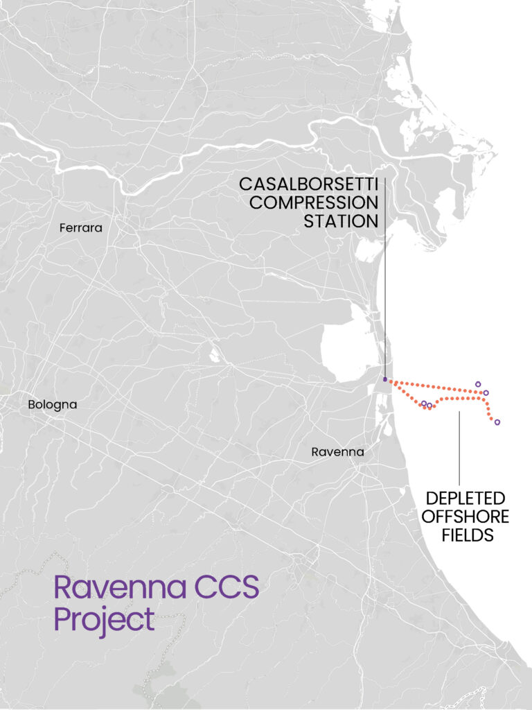
1. A large CO2 storage facility in Ravenna
“Ravenna CCS” is a carbon dioxide capture and storage project promoted by a joint venture between two large Italian publicly controlled fossil fuel corporations: ENI and Snam. The project, currently in its pilot phase, aims to build a series of onshore and offshore infrastructures designed to collect and transport CO2 from Emilia Romagna and Veneto to ENI’s depleted fields in the Upper Adriatic (Porto Corsini Mare Ovest, with the PCW-T, PCW B-C, Agostino C, Garibaldi C and Garibaldi D platforms). This raises a number of critical issues.
Among these is an initial “anomaly”. The Ministry of the Environment has in fact established that it will be able to make use of “companies with proven experience in the fields of CO2 capture, transport and storage” to prepare the study that will structure the legislation, as well as the technical, economic and financial regulation of the CCS supply chain in Italy. ENI and Snam would therefore find themselves writing regulations that could grant them generous remuneration for the “service” offered, in a clear conflict of interest.
On the map: location of the Casalborsetti compression station and CO2 transport infrastructure to depleted offshore fields. Graphic design: PlaceMarks.
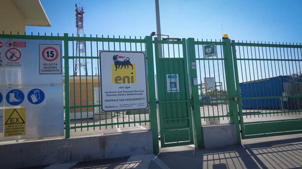
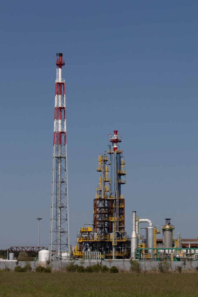
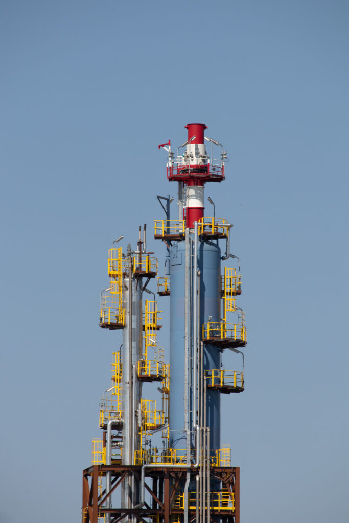
ENI plant in Casalborsetti, (Ravenna). This is where the gas extracted by ENI from various offshore fields in the northern Adriatic is collected and processed. This plant is the first to which ENI is applying CO2 capture technology (Photo ReCommon/2025).”
2. CCS Pianura Padana
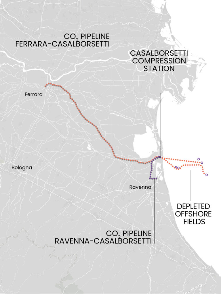
The “Ravenna CCS” project is linked to another project promoted by Snam, the “CCS Pianura Padana”, which involves the construction of a network of approximately 100 kilometres of pipelines dedicated to the transport of carbon dioxide. The aim is to convey the carbon dioxide initially collected from the industrial areas of Ferrara and Ravenna, and subsequently also from the industrial hub of Marghera, to the industrial collection and liquefaction plant to be built in Casalborsetti, from where it will finally be transported and injected into depleted reservoirs at the bottom of the Adriatic Sea.
The collection of CO2 from these plants would take place in the so-called Phase 2, or industrial phase of the project, in which ENI and Snam promise to transport and bury up to 4 million tonnes of CO2 per year by 2030. The project includes a further phase called “CALLISTO” in which, together with the French company Air Liquide, ENI and Snam plan to collect and store up to 16 million tonnes of CO2 per year coming from France.
For a more detailed description of the project, read the report “The false solution of Ravenna”.
On the map: location of the CO2 pipeline route from Ferrara to Casalborsetti (CCS Pianura Padana), the CO2 pipeline from the Ravenna industrial area to Casalborsetti, towards the compression station, and the CO2 transport infrastructure to the depleted offshore fields. Graphic design: PlaceMarks.
3. Departure and arrival
If we look at the details and examine the cities of departure and arrival of the pipeline:
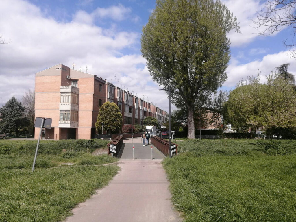
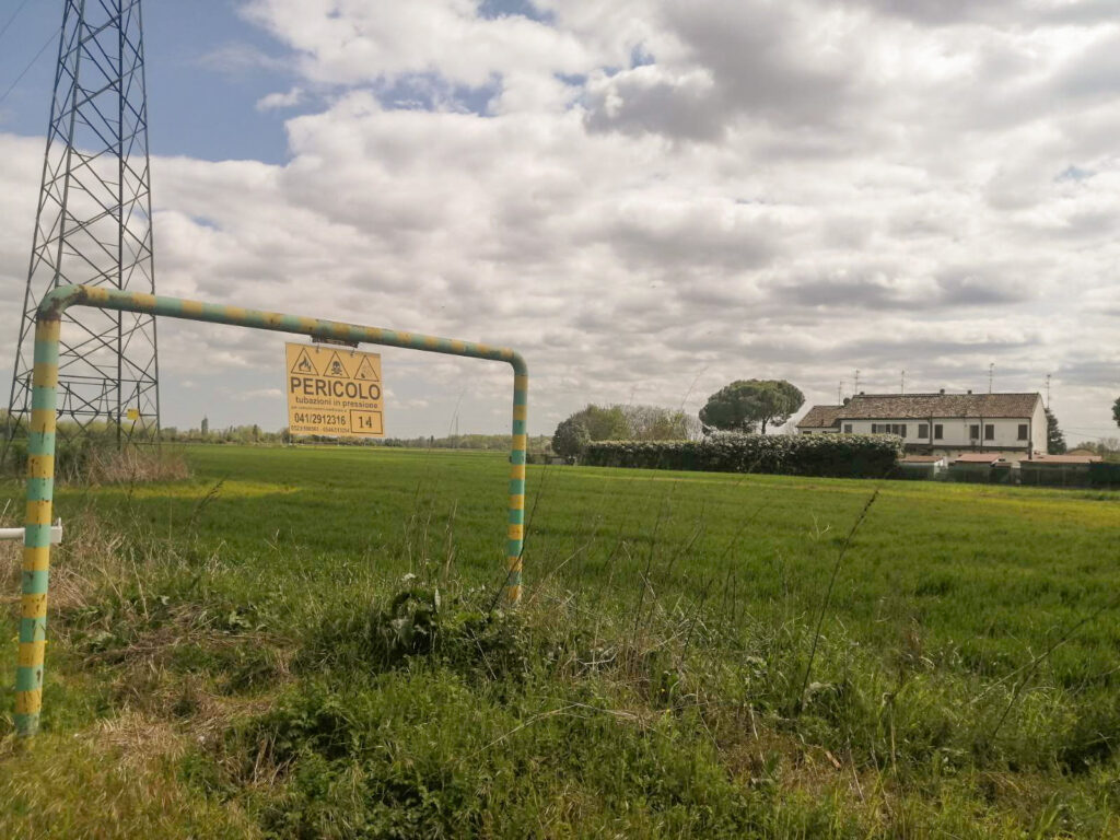
In Ferrara, the initial section of the CO2 transport pipeline will pass through Pontelagoscuro and the area known as the “Villaggio marchigiano” (Marche village), just a few metres from residential areas, as can be seen from the official project documentation available on the Ministry of the Environment’s website and from photos taken by ReCommon of the area affected by the infrastructure. The risk of having such infrastructure so close to homes is described in an investigation by the Huffington Post, which collected testimonies from residents of Satartia, Mississippi, where in February 2020, following the rupture of a CO2 transport pipeline, the entire population was evacuated along with 250 other people living nearby.
None of the rescue workers or medical personnel were prepared to deal with the consequences of prolonged exposure to high concentrations of CO2.

ENI signage near the Villaggio marchigiano (Ferrara) and the proximity of homes to the pipeline route (Photo ReCommon/2025)
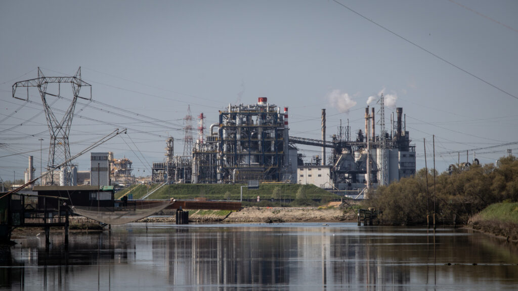
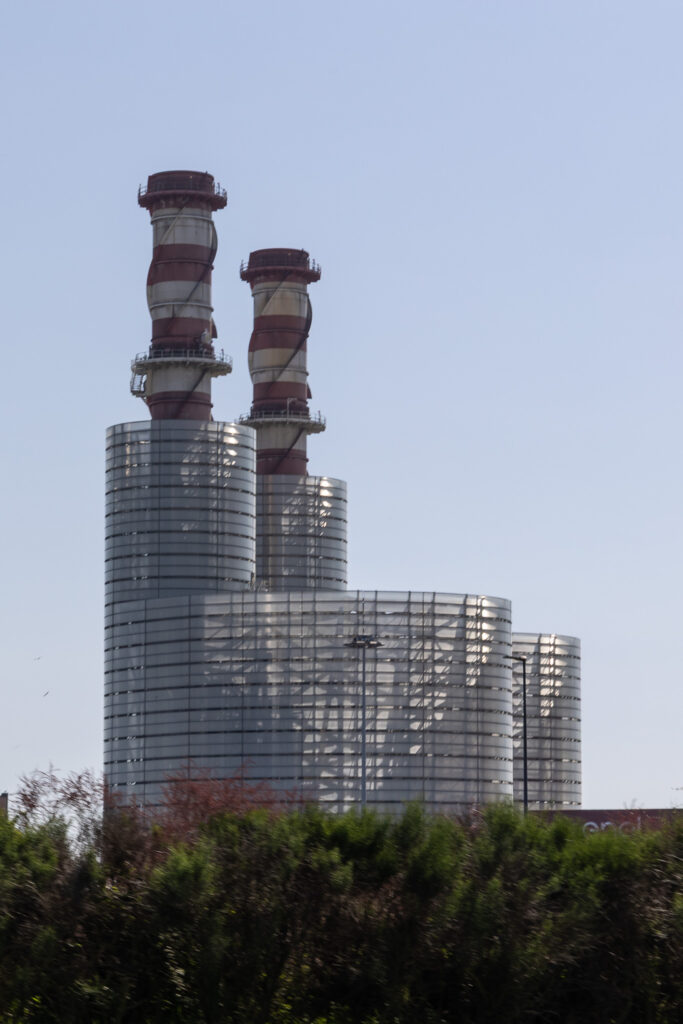
Although not directly affected by the gas pipeline, the city of Ravenna is characterised by a chemical and industrial district that stretches for kilometres along the coast, a parade of heavy industries that make the air difficult to breathe: from Marcegaglia to Italcementi and Yara, passing through the ENI-Versalis petrochemical plant and various LNG depots.
VIDEO OVERVIEW OF THE INDUSTRIAL AREA:
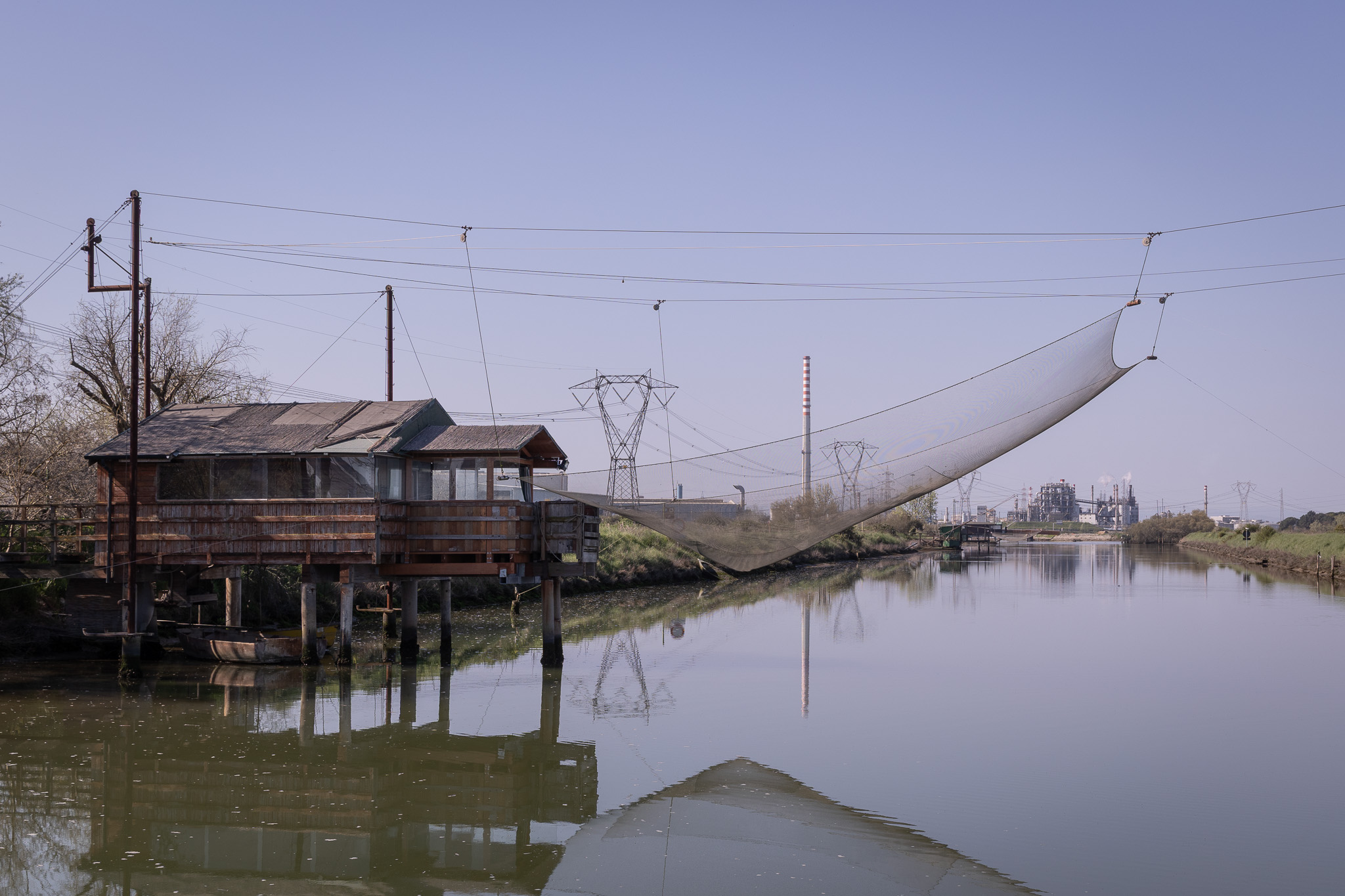
This is the scenario that one encounters if, for example, one wishes to visit the natural area (corresponding to the Site of Community Importance (SCI) and Special Protection Area (SPA) Pialasse Baiona, Risega and Pontazzo) surrounding the Capanno Garibaldi (Garibaldi shed).
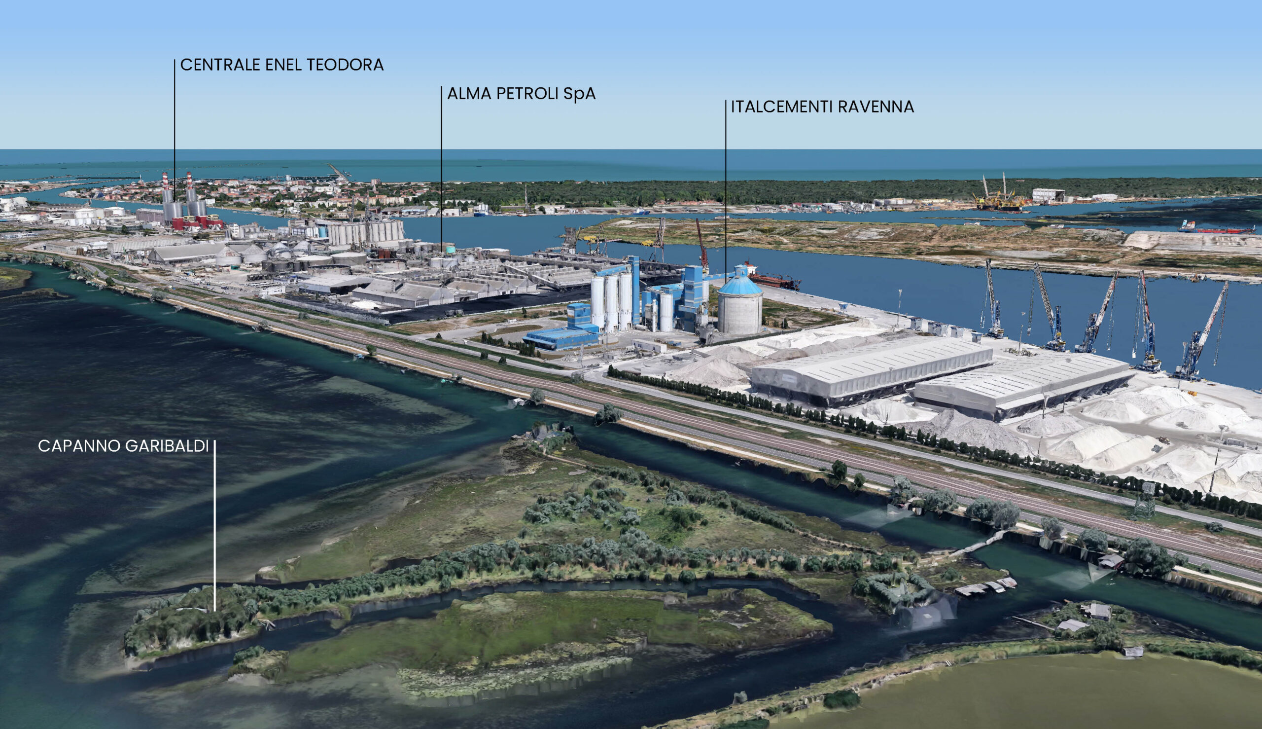
The natural area is part of the Po Delta Park and includes a large brackish lagoon connected to the sea by canals, with shallow waters and silty-clayey bottoms. It is also considered a wetland of international importance. The Pialassa would be the perfect place for birdwatchers if only the imposing chimneys of the industrial area did not appear in the lenses of their binoculars. A truly striking visual contrast.
Images of the vast industrial area of Ravenna near the nature reserve (Photo ReCommon/2025)
4. The regional context
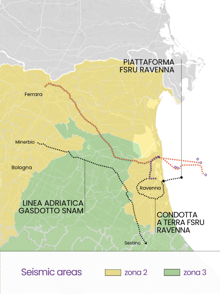
But in what context will this additional infrastructure be built?The territory covered by this project is dotted with Natura 2000 areas, i.e. areas of natural value and high biodiversity protected by Italian and European legislation but threatened by the numerous forms of extractivism present in Emilia Romagna, including Snam’s inevitable fossil fuel interests: the installation of a regasification ship 8.5 km off the Ravenna coast and the Adriatic Line, a mega gas pipeline that runs up the Apennine ridge across the entire peninsula to Minerbio (near Bologna). All this in an area characterised by a medium-high seismic risk, with the possibility of strong earthquakes that could cause serious damage to water, natural gas and CO2 pipelines.
On the map: location of Sites of Community Importance (SCI) and Special Protection Areas (SPA) in the area crossed by CO2 transport pipelines. Graphic design: PlaceMarks.
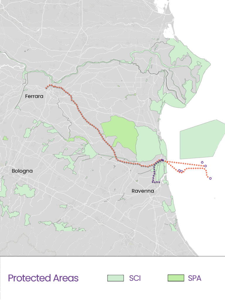
The areas of natural value in the provinces of Ravenna and Ferrara shown on this map refer to 12 Natura 2000 sites that are expected to suffer direct or indirect impacts related to the construction and operation of the CO2 transport pipeline. Among these, the San Vitale Pine Forest and the Alfonsine and Reno River biotopes are those for which a direct impact is expected, but a dozen other sites are located less than 5 km from the construction site, with the closest being about 800 metres away.
These include the Po Delta Park, the Comacchio Valleys, the Mezzano Valley, the Vene di Bellocchio (water courses fed by the channel Bellocchio) and the mouth of the Reno river, Punte Alberete, Valle Mandriole, Bardello, Pialasse Baiona and several others. In total, there are 71 waterways that will be crossed by the project and its construction sites. Snam talks about trenchless crossings, i.e. using microtunnels, but this does not mean that there will be no impact on the numerous species that inhabit the rivers and habitats concerned.
On the map: graphic overlay of seismic areas, route of the gas pipeline for CO2 transport and for gas transport and regasification (Sestino-Minerbio Adriatic Line, Ravenna FSRU and onshore pipeline). Seismic classification: Zone 2 – Strong earthquakes are possible in this zone (medium-high risk); Zone 3 – In this zone, strong earthquakes are less likely than in zones 1 and 2 (medium-low risk). Graphic design: PlaceMarks
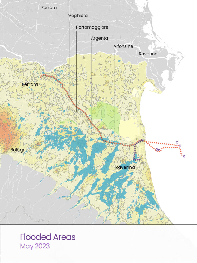
5. Seismicity and flooding
This additional infrastructure would therefore be located in an area with a high seismic risk and which we know to be subject to increasingly frequent extreme weather events, such as the floods of 2023 and 2024, which caused persistent flooding and extensive damage to local communities.
In April 2025, we visited Traversara, the hamlet of Bagnacavallo destroyed by the flood of September 2024, where we collected testimonies and took some photos showing the devastating impact of the Lamone River flood on the communities. Photojournalist Michele Lapini accompanied us on this trip. Here are some of his photos taken immediately after the floods of May 2023 and September 2024.
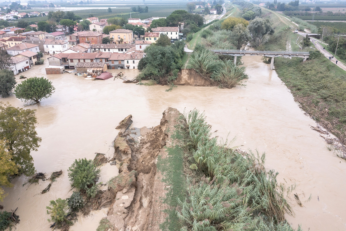
Traversara (Ravenna), 19 September 2024. Photo ©Michele Lapini
A year after this latest catastrophic event, communities are still waiting for reconstruction and compensation for the damage they suffered, but they are also wondering what the future holds for them if the climate crisis continues to advance and with it extreme weather events. Who will pay the social costs of all this?
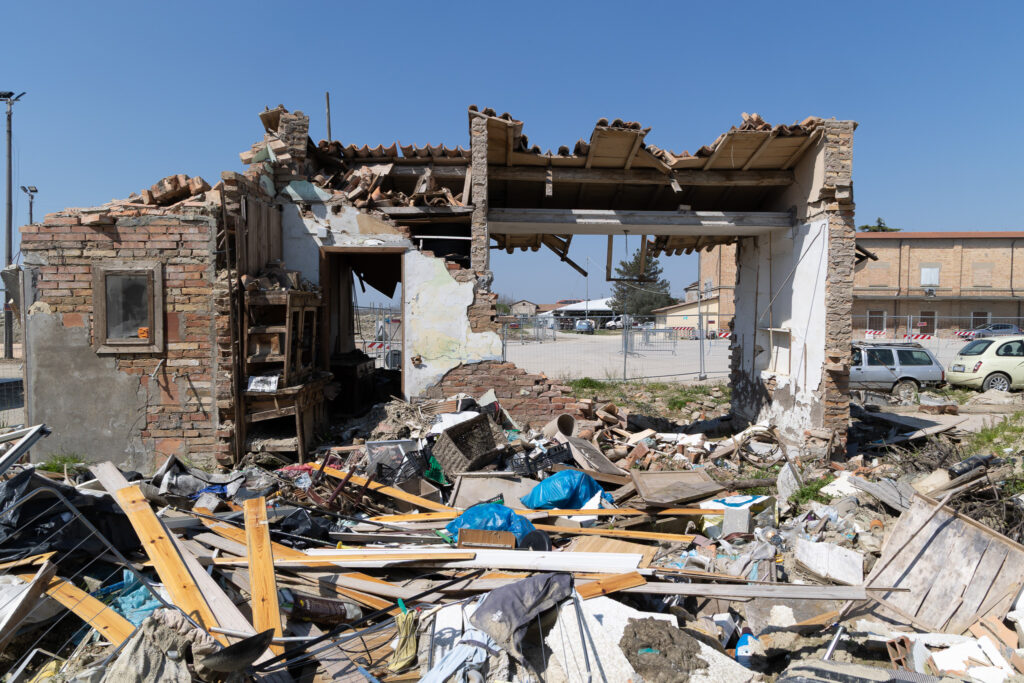
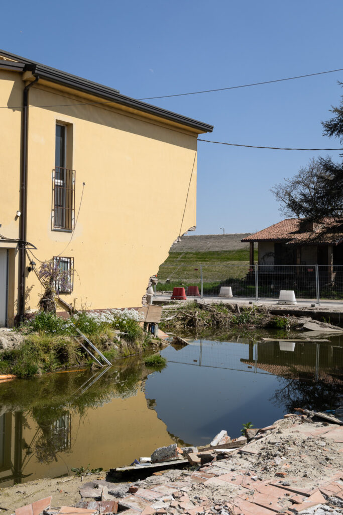
Traversara (Ravenna), April 2025. Photo Carlo Dojmi di Delupis ©ReCommon
6. Subsidence
Subsidence is a process of vertical lowering of the ground, which can have both natural and artificial or anthropogenic causes, i.e. causes linked to human actions. In the case of the Polesine geographical region, between Veneto and Emilia Romagna, the main cause is the extraction of fluids from the subsoil (water, oil, gas) that began in the 1940s. It is a phenomenon with significant effects.
And today we know, thanks to the important study by Professor Bernard Schrefler for the Galilean Academy of Sciences, Letters and Arts in Padua, that the flooding and accumulation of water during the floods that hit Emilia Romagna in 2023 and 2024 were exacerbated by subsidence induced by gas extraction on land and at sea, carried out by ENI and which, since the 1950s, have affected the areas around Ravenna but also its hinterland and the Bologna area.
On the map: the route of the CO2 transport pipelines superimposed on the areas affected by subsidence induced by gas extraction and hit by flooding and water accumulation during the floods of 2023 and 2024. Graphic design: PlaceMarks
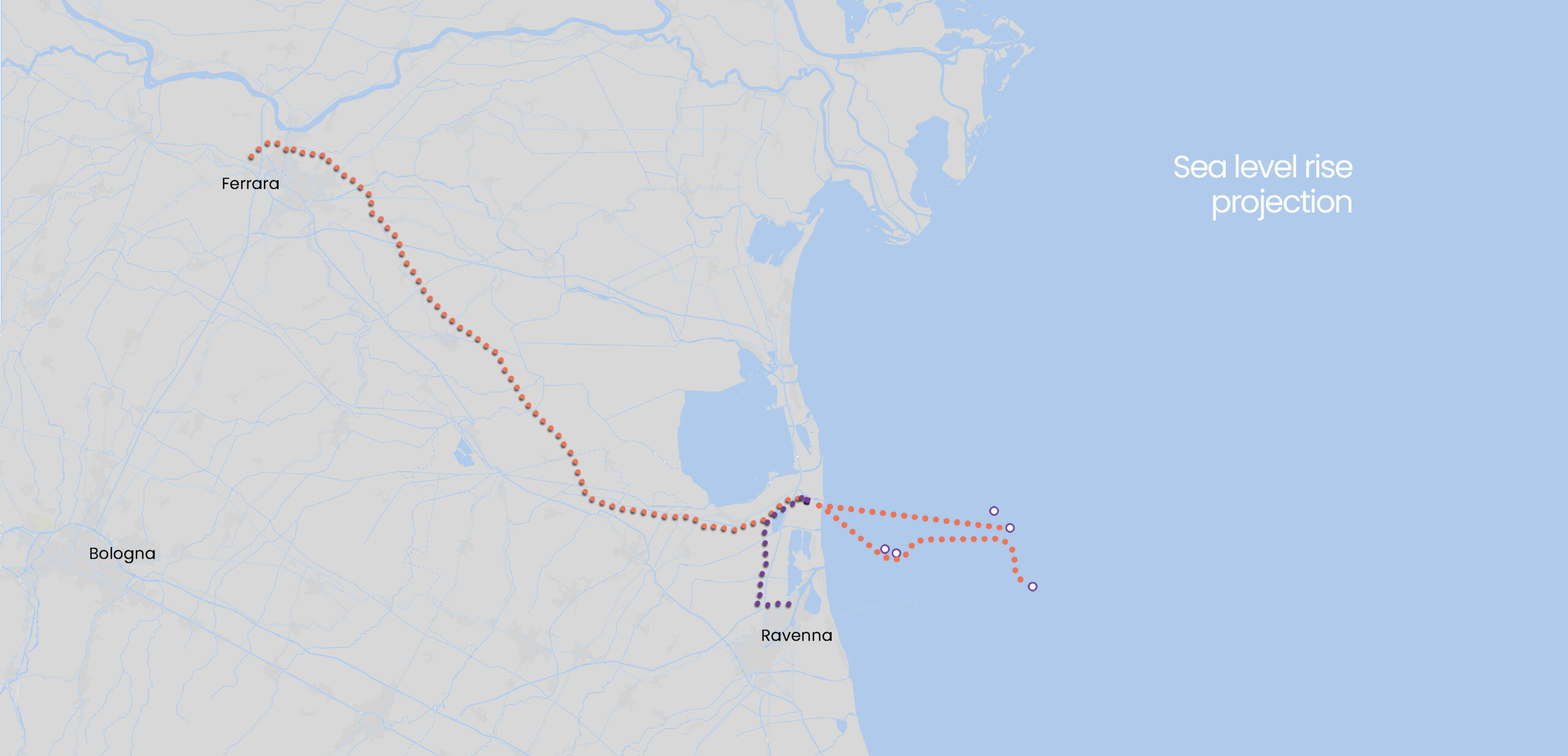
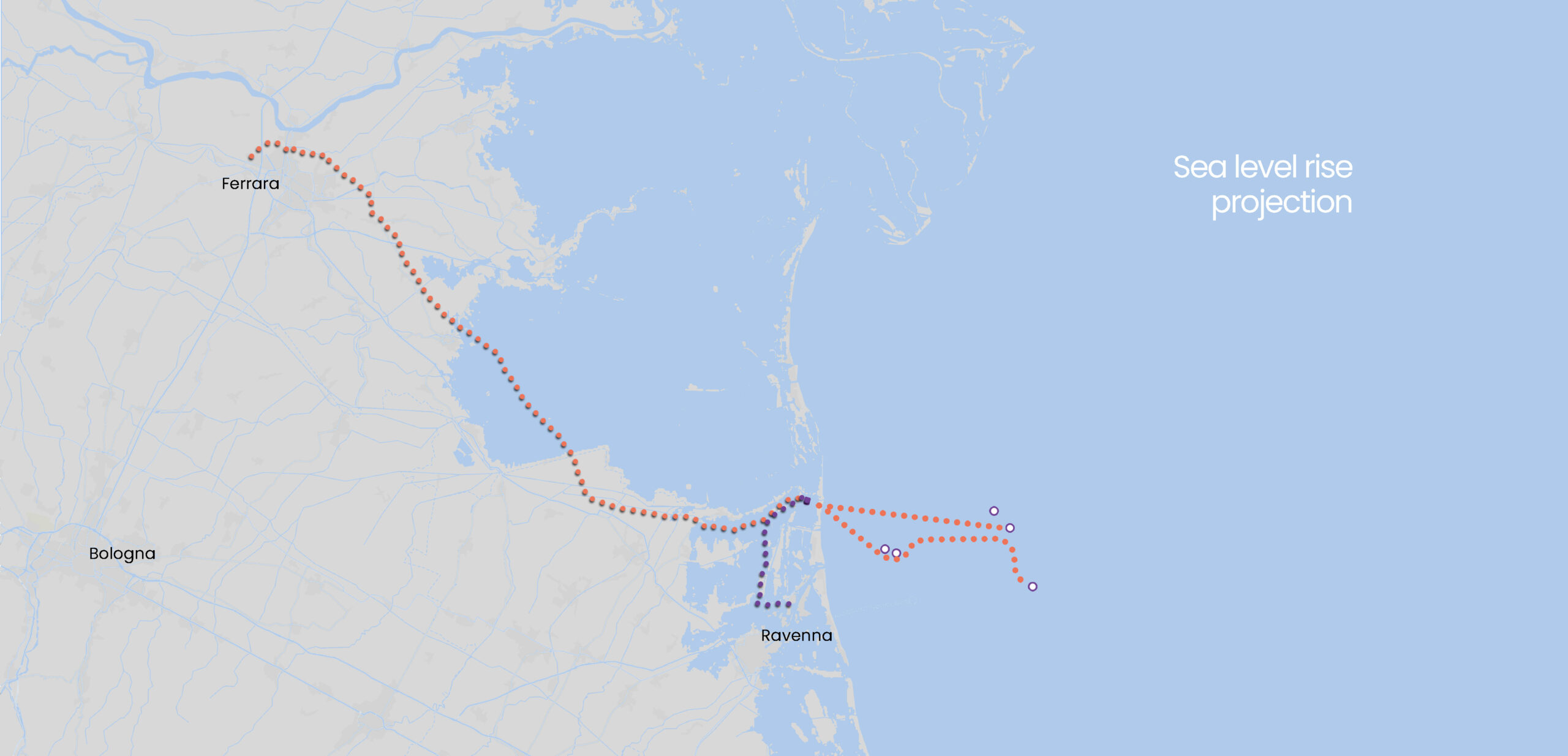
7. The advancing sea
Projections by the CoCliCo – Coastal Climate Core Services climate service on coastal areas at risk of flooding due to sea level rise predict that by 2100, much of the Po Valley will be submerged by the sea. Much of this land, including the province of Ferrara, was “reclaimed” from the sea through land reclamation projects carried out at the beginning of the last century, and now the sea is reclaiming it. This includes the area that is to be crossed by CO2 transport pipes and other infrastructure. Will it really be possible to guarantee its integrity and “permanent” storage, i.e. for the next thousands of years?
On the map: Overlay of CO2 transport infrastructure and projected sea level rise by 2100 according to Coastal Climate Core Services data. Graphic design: PlaceMarks
8. Conclusions
There are too many unanswered questions behind the project to transform the Po Valley, and in particular the provinces of Ferrara and Ravenna, into a large CO2 transport and storage network. The grand plan of ENI and Snam also involves conveying hundreds of thousands of tonnes of liquid CO2 from the industrial districts of the Rhône Valley, Fos and Etang de Berre in France, which are expected to arrive by ship from the port of Marseille. This high-risk project, called CALLISTO, would become the physical basis for the development of a CO2 market in the Mediterranean and would seal Ravenna’s industrial fate and its status as a sacrifice zone for decades to come. The same area is also on the front line for extreme weather events, which are only set to increase in frequency and intensity in the coming years without a transformation of the energy and production model, starting with the abandonment of fossil fuels.
There are many unanswered questions, ranging from a lack of transparency on many aspects of the project to the absence of an informed and participatory public debate that could assess the costs and benefits for the entire area. This discussion should have taken place even before the launch of the ENI and Snam pilot project, which began in 2024 without an environmental impact assessment. On the contrary, the decision to start the authorisation procedures for the first onshore infrastructure under a fast-tracking procedure has made it even more difficult for municipalities, institutions and those living in the area to understand the long-term implications of this major project. From our point of view, it is paradoxical to rely on fossil fuel companies to find “technological solutions” to ‘solve’ the climate crisis that they themselves have helped create.
*Satellite image processing and mapping by PlaceMarks
Source of data for map processing: public documentation filed by Snam on the website of the Italian Ministry of the Environment and Energy Security in the Environmental Impact Assessment procedure for the CCS Pianura Padana project – CO2 Transport Network, Ferrara-Casalborsetti and Ravenna-Casalborsetti gas pipelines.